Hiking Near Marmaris 2026: National Park, Datça Trail and Carian Route
Book an experience
Things to do here
The top-rated tours and activities here — all with instant confirmation and free cancellation on most bookings.
Marmaris sits inside Marmaris National Park — the protected pine and cedar forest that covers the steep hills surrounding the bay. This gives walkers immediate access to serious trails directly from the town, without needing transport. Combined with the Carian Heritage Trail that passes through the area and the tracks of the Datça Peninsula to the west, the Marmaris area has more walking than its beach-resort reputation suggests.
The landscape is characteristically Aegean Marmaris — pine and cedar forest on limestone ridges, maquis scrub on the exposed coastal slopes, and abrupt drops to the sea. The terrain is steep: even short trails gain significant elevation quickly. Bring water.
For Marmaris context, see things to do in Marmaris.
Marmaris National Park
Marmaris National Park covers the forested peninsula and hills surrounding the bay — one of the largest protected areas on the Muğla coast. The park designation protects forest that would otherwise have been developed, and the result is that most of the hillsides above the town remain wild and walkable.
Entry: No formal entry fee for most trail access. The national park boundary begins at the treeline above the built area.
Trail access from town: Several trails begin at the edge of the Marmaris urban area and climb directly into forest. The most used route starts near the Atatürk statue area and climbs toward the ridge behind the castle hill.
What to expect: Mixed pine and cedar forest on limestone slopes. The trails are not systematically waymarked but are well-worn and navigable with basic map reading. Trail conditions are dry and dusty June–September; good October–May.
Castle Hill and Bay Ridge Loop
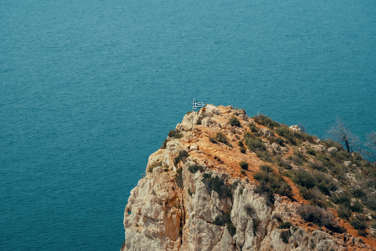
The most accessible walking from central Marmaris is the ridge above the castle district — a 3–4 hour loop that delivers panoramic views of the bay, the islands, and the mainland coastline.
Route: Start at the castle (Marmaris Kalesi) and follow the road and then trail behind the castle hill toward the ridge. The trail climbs steeply through pine forest before levelling out on the ridge crest. From the ridge, views extend over the full bay, the cluster of islands to the south, and on clear days toward the Greek island of Rhodes.
Distance: 8–12km circular.
Elevation gain: 300–400m.
Duration: 3–4 hours.
Difficulty: Moderate — steep in sections, no technical difficulty. Good footwear required; the limestone is loose on steeper sections.
Water: None on trail. Carry 2–3 litres.
Best season: October–May. July–August is manageable but hot and exposed on the ridge.
Marmaris to Içmeler Coastal Trail
A trail follows the coastline and hillsides between Marmaris town and Içmeler (8km west) — an alternative to the dolmuş that gives views of the bay coves inaccessible by road.
Route: The trail begins at the western end of Marmaris marina and follows the hillside above the rocky coastal sections, passing several small coves before descending to the Içmeler beach. The path passes above accessible swimming spots — feasible as a half-day with swimming stops.
Distance: 8km one-way (16km return or dolmuş back).
Duration: 2–3 hours one-way.
Elevation gain: 150–250m (several ups and downs following the coastal topography).
Difficulty: Easy to moderate. Some scrambling near the coves.
Return: Dolmuş from Içmeler back to Marmaris (₺15, frequent departures).
Carian Heritage Route
The Carian Heritage Route is a long-distance walking trail across the ancient Carian heartland of Muğla province — connecting Bodrum, Marmaris, Datça, and numerous ancient Carian sites. The Marmaris section passes through Marmaris National Park and into the hills above the town.
Total route distance: Over 800km (the full Carian circuit across southern Turkey and into Greece).
Marmaris-area section: The trail enters from the east (from Orhaniye village area) and passes through the forest behind Marmaris town before continuing west toward Datça. This section is 3–4 days’ walking.
Day section from Marmaris: The 12–15km section from the Marmaris National Park entrance toward Bozburun village is walkable as a long day hike (5–7 hours) with transport back.
Waymarking: The Carian Route is waymarked with red-white paint blazes similar to international long-distance routes. More reliable in the wilderness sections than in village approaches.
Information: Carian Routes Association maintains information about the trail. Maps available for purchase (₺80–150); digital GPS tracks available free.
Bozburun Peninsula Trail
The Bozburun Peninsula extends south of Marmaris — a rugged 50km peninsula with the village of Bozburun at its tip. Walking sections of this peninsula gives access to the most isolated coastline in the Marmaris area.
Access: Dolmuş or taxi from Marmaris to Orhaniye or Selimiye village (30–45 minutes, ₺30–80), then walk from there.
Selimiye to Bozburun section: 15–20km along the peninsula’s spine, with sea views on both sides. The trail passes through maquis, olive groves, and the villages of Taşlıca and Söğüt.
Duration: Full day (7–9 hours) for the Selimiye-Bozburun section.
Difficulty: Moderate — sustained but not technically demanding.
Return: Dolmuş from Bozburun (afternoon service, confirm times).
Datça Peninsula Walking
The Datça Peninsula extends 70km west of Marmaris — one of Turkey’s most remote and least-developed coastal areas. The peninsula has walking tracks through almond and olive orchards, along cliffs above the sea, and to the ancient Greek city of Knidos at the tip.
Access from Marmaris: Shared minibus or car hire (90 minutes to Datça town; 2.5 hours to Knidos). Not practical as a day hike from Marmaris without an early start.
Knidos walks: The area around ancient Knidos (₺200 entry) has walking among the ruins and along the cliff paths above the Mediterranean-Aegean meeting point. A 3–4 hour circuit covers the main ruins and the cape.
Datça town to Eski Datça: 3km walk between the modern port town and the old village (Eski Datça/Old Datça) — almond orchards, stone houses, atmospheric in spring when the almonds blossom.
Almonds: The Datça Peninsula almond orchards are worth walking through in March (blossom season) or September (harvest). The small, intensely flavoured Datça almonds are what distinguishes local food here.
Turunc to Marmaris Sea-Side Trail
Turunc village (15km south of Marmaris) is connected by a coastal trail that follows the hillside above the sea. The trail is used by locals between the two settlements and passes through the wild stretch of coast between the two bays.
Route: From Turunc village, the trail climbs out of the bay, traverses the headland through pine forest, and descends toward the Marmaris National Park coastal area.
Distance: 10–14km one-way.
Duration: 3–4 hours.
Difficulty: Moderate to strenuous — significant elevation gain leaving Turunc.
Return: Sea taxi from Marmaris back to Turunc (₺60, year-round service), or dolmuş via the road.
Day hike summary
| Route | Distance | Duration | Difficulty | Transport needed |
|---|---|---|---|---|
| Castle Hill loop | 8–12km | 3–4 hrs | Moderate | None |
| Marmaris–Içmeler coastal | 8km one-way | 2–3 hrs | Easy–Moderate | Return dolmuş |
| Carian Route (day section) | 12–15km | 5–7 hrs | Moderate | Return transport |
| Bozburun Peninsula | 15–20km | 7–9 hrs | Moderate | Dolmuş to start |
| Turunc–Marmaris | 10–14km | 3–4 hrs | Mod–Strenuous | Sea taxi return |
Practical information
Season: October–May is ideal — cooler temperatures, lower fire risk, green vegetation. June–September is walkable in the early morning but hot by 10am. July–August fire season means some trails in the national park may be temporarily closed.
Footwear: Proper hiking shoes or trail runners required. The limestone terrain is rough and the slopes are steep. Sandals are inadequate for any route beyond the castle area.
Water: No reliable water sources on most routes. Carry minimum 2 litres for a half-day; 3–4 litres for a full day.
Navigation: Marmaris National Park trails are not comprehensively waymarked. Maps7 or Wikiloc GPS tracks recommended for the longer routes. The Carian Route blazes are the most reliable marking in the area.
Wildlife: Pine processionary caterpillars (March–May) are present in the forests — avoid contact with the white silken nests in pine trees. Snakes (including vipers) exist in the rocky sections — watch where you step.
Fire restrictions: Smoking prohibited in the national park. Campfires strictly prohibited May–October.
Emergency: Turkish emergency services (112); Marmaris National Park management (Marmaris town centre).
For coastal scenery from the water, see beaches in Marmaris. For Datça Peninsula details, see coastal towns near Marmaris.
Ready to explore?
Browse hundreds of tours and activities. Book securely with free cancellation on most options.
Browse on GetYourGuide →We may earn a small commission — at no extra cost to you.