Hiking Near Bodrum: Peninsula Trails and Carian Heritage Routes
Book an experience
Things to do here
The top-rated tours and activities here — all with instant confirmation and free cancellation on most bookings.
The Bodrum Peninsula’s rocky limestone hills, coastal cliffs, and ancient track network provide hiking that most visitors completely overlook in their beach and nightlife focus. The trails are less dramatic than the Lycian Way further east but have their own character: rocky coastline, ancient Carian ruins visible in the landscape, olive groves, and Aegean views throughout. The best hiking season is October–May; summer hiking is possible in the cooler early morning but the terrain offers little shade.
Carian Heritage Route (Karia Yolu)
Distance: 820km total; day sections 8–20km Difficulty: Moderate Season: October–May Trailhead access: From Bodrum town, Milas, or various Peninsula villages
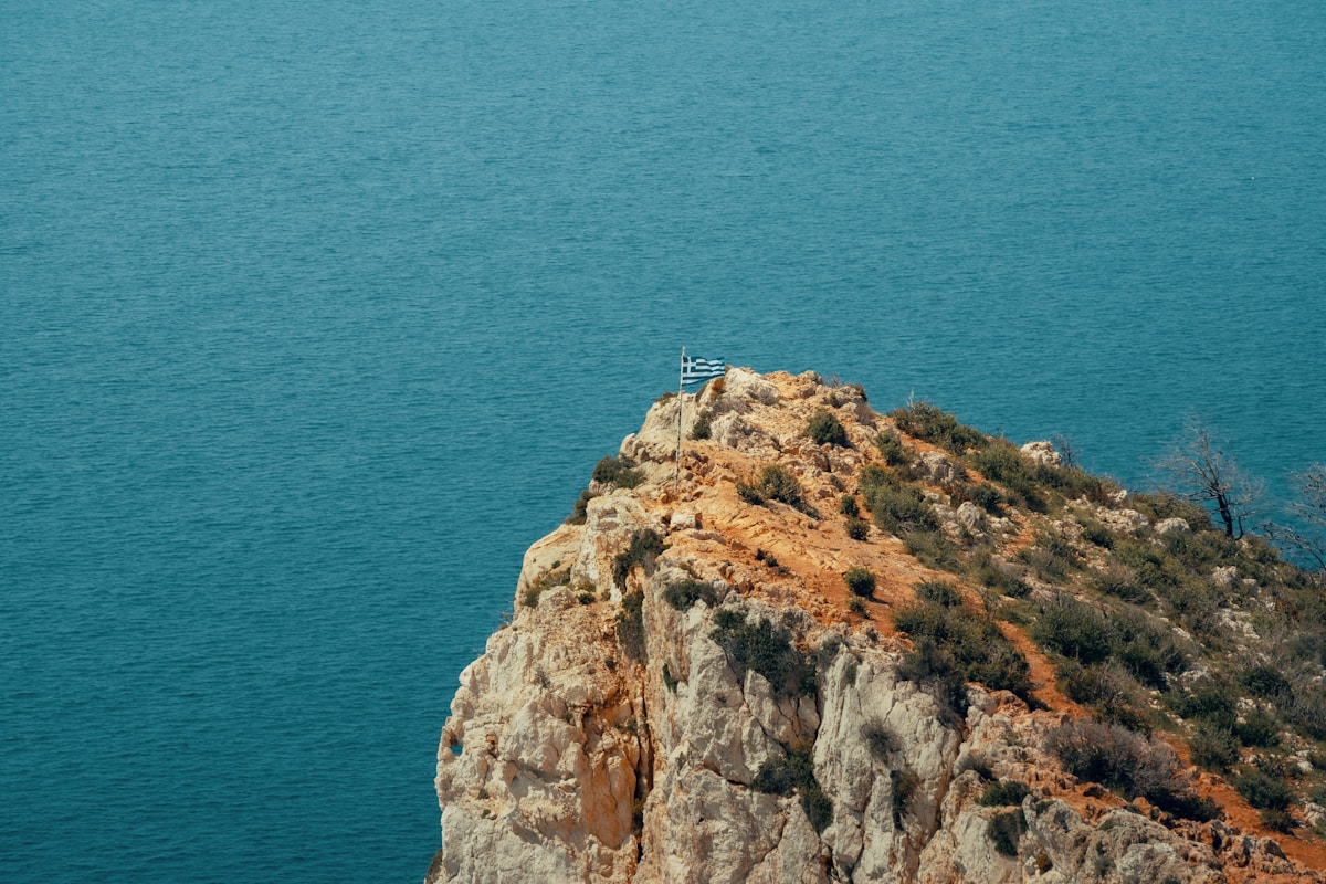
The Carian Heritage Route is a long-distance trail through the ancient territory of Caria — a walking route that connects archaeological sites, Carian rock tombs, and mountain villages across the Muğla and Aydın provinces. It was developed in the 2010s following the model of the Lycian Way and covers terrain that includes the Bodrum Peninsula, the Muğla mountains, and the inland Carian heartland.
Peninsula sections from Bodrum: The route runs through the Peninsula’s interior hills and coastal cliffs, passing through the villages of Gümüşlük, Kadıkalesi (Carian ruins), Mumcular, and onward to Milas. The coastal sections offer Aegean views throughout; the inland sections pass olive groves and Carian tomb-cut cliffsides.
Day sections accessible from Bodrum:
- Bodrum to Gümüşlük: 16km, moderate, coastal trail with Aegean views
- Gümüşlük to Yalıkavak: 12km, moderate, ridge trail connecting the two best villages on the Peninsula
- Yalıkavak to Gündoğan: 8km, easy-moderate, bay views
Bodrum to Gümüşlük: the Peninsula coastal walk
Distance: 16km one way Elevation gain: 400m cumulative Duration: 5–6 hours Difficulty: Moderate Return: Dolmuş from Gümüşlük to Bodrum, ₺25
One of the best full-day walks on the Peninsula — a coastal and inland trail from Bodrum town to the fishing village of Gümüşlük on the far western tip. The trail follows the Carian Heritage Route markers (red-and-white blazes) and passes through the Kıyıkışlacık area (ancient Myndos territory), with views across the Aegean to the Greek islands of Kos and Kalymnos throughout the upper sections.
The reward at the end: Arrive in Gümüşlük in time for a sunset fish dinner — the combination of a walking day and an octopus dinner at the village harbour is one of the best days the Peninsula offers. Take the late dolmuş back (confirm last departure time before walking).
Practical: Start from Bodrum by 7:30am. Carry 2–3 litres of water (no sources on the trail). The trail is partially marked; download the GPX track from wikiloc before departure.
Gümüşlük to Yalıkavak: ridge walk
Distance: 12km one way Elevation gain: 300m Duration: 3.5–4.5 hours Difficulty: Moderate Return: Dolmuş from Yalıkavak to Bodrum (₺25), then connecting service
A ridge walk connecting the two best village destinations on the Peninsula — mostly inland with occasional sea glimpses, through olive groves and rocky terrain. Arrive in Yalıkavak at lunchtime; eat at a harbour fish restaurant; take the dolmuş back.
Peninsula village walking: shorter options
Torba to Bodrum: 8km coastal path, easy, 2–2.5 hours. Accessible from Torba village (dolmuş from Bodrum, ₺15). The coastal path is partly paved, partly rough track.
Bitez village walks: The hills behind Bitez village (inland from the beach) have unmarked tracks through olive groves — good for a morning 2-hour walk without navigational challenges.
Gündoğan peninsula: A small headland at the northern end of the Peninsula offers easy walking on a track around the headland with views across Gündoğan bay. 4–5km round trip; 1.5 hours.
Inland day trips: Muğla mountains
The mountains inland from Bodrum (the Menteşe Mountains) are significantly more dramatic than the Peninsula hills and offer proper hiking rather than coastal walking — but require a car or taxi to reach the trailheads.
Muğla city and surroundings (75km northeast): The provincial capital has access to forested mountain trails in the Muğla mountains. Day trip by bus (1.5 hours), or base in Muğla for hiking access.
Marmaris National Park connection: The mountains between Bodrum and Marmaris (150km east) include some of the best hiking terrain in the region. Accessible as a day trip with a hire car.
Ancient sites on foot from Bodrum
Several ancient Carian sites are reachable by walking from Peninsula villages:
Myndos (Gümüşlük): The ruins of ancient Myndos are partially submerged in Gümüşlük bay (visible through clear water) and partially visible on the headland above the village. Walk around the headland from Gümüşlük village: 2km, 45 minutes.
Pedasa (above Bitez): Ruins of an ancient Carian hill city above Bitez — accessible by a 2–3 hour uphill walk from the village. Largely unexcavated; atmospheric ruins in pine forest.
Myndos Gate (Bodrum town): The only surviving section of ancient Halicarnassus’s city walls, near the Bodrum marina. Walk: 10 minutes from the harbour.
Hiking logistics from Bodrum
| Route | Distance | Duration | Access | Return |
|---|---|---|---|---|
| Bodrum to Gümüşlük | 16km | 5–6 hrs | Walk from town | Dolmuş ₺25 |
| Gümüşlük to Yalıkavak | 12km | 4–5 hrs | Dolmuş to Gümüşlük | Dolmuş ₺25 |
| Torba to Bodrum | 8km | 2–2.5 hrs | Dolmuş to Torba | Walk end |
| Gündoğan headland | 5km | 1.5 hrs | Dolmuş to Gündoğan | Same dolmuş |
Essential kit
The Peninsula terrain is rocky limestone — ankle-support shoes or trail runners at minimum. Sun protection essential from April–October. Water: carry 2–3 litres regardless of distance (no trail-side sources). Navigation: the Carian Heritage Route is marked but sections between villages can be unclear — download GPX tracks from wikiloc or maps.me before departure.
For longer Carian Heritage Route sections and the mainland hills, the 1:25,000 maps for the Bodrum/Muğla area are available at map shops in Bodrum town.
For hiking in the wider Aegean coast region, see hiking near Marmaris and hiking near Kaş (Lycian Way).
Ready to explore?
Browse hundreds of tours and activities. Book securely with free cancellation on most options.
Browse on GetYourGuide →We may earn a small commission — at no extra cost to you.