Hiking Near Antalya: Taurus Mountains and Lycian Way
Book an experience
Things to do here
The top-rated tours and activities here — all with instant confirmation and free cancellation on most bookings.
The Taurus Mountains rise steeply behind Antalya to over 2,000m within 30km of the coast — an unusual geography that puts serious alpine terrain within day-trip range of a sea-level beach city. The Köprüçay river gorge, the Termessos ruins at 1,000m altitude, the western section of the Lycian Way, and the broader Beydağları (Bey Mountains) national park provide hiking options from afternoon walks to multi-day treks. The key advantage over the more famous Cappadocian or Aegean trails is access: buses and dolmuş from Antalya can reach most trailheads in under two hours.
The best hiking season is October–May. Summer hiking in the Taurus above 1,000m is manageable; below that, temperatures exceed 35°C regularly from June–September and the coastal trails become unpleasant in afternoon heat.
Termessos: mountain ruins hike
Distance: 5–8km return depending on route Elevation gain: 400m from car park to main ruins Difficulty: Moderate (rocky, unshaded sections) Duration: 3–5 hours Entry: ₺200 national park + ₺200 site Access: 30km northwest of Antalya — dolmuş toward Korkuteli, then taxi (₺150–200 round trip) or organised tour
Termessos is both the best hiking destination near Antalya and the most interesting ancient site in the region after Aspendos. A Pisidian mountain city at 1,050m in the Güllük Mountain National Park — Alexander the Great assessed the walls and decided the siege wasn’t worth the losses. The ruins are dramatically atmospheric: collapsed temples and necropolis tombs in pine forest, with Antalya bay visible on clear days from the theatre’s upper tiers.
The trail from the car park to the main ruins (agora, theatre, necropolis) is 40–45 minutes of uphill hiking on rocky path through pine and cedar. Take water — none available on the trail. Condor vultures nest in the cliff faces above the theatre; their wingspan (2.5m+) is visible overhead.
Extended route: From the main ruins, a further 30 minutes uphill reaches the highest necropolis section with the best coastal views. This adds 200m elevation and significant rocky scrambling; appropriate footwear required.
Practical: The site is almost entirely unvisited on weekdays — you may have the ruins to yourself. Weekends bring more visitors but still nothing like the crowds at Aspendos. Hire a car for the most flexibility; the taxi option leaves you waiting at the trailhead unless you arrange collection.
Köprülü Canyon: gorge trails and rafting
Distance: Varies — gorge walks 2–8km Elevation gain: Minimal (gorge floor walking) Difficulty: Easy to moderate Duration: Half day to full day Access: 90km from Antalya — dolmuş to Serik, then taxi or organised trip; 2 hours from city
The Köprüçay (Eurymedon) river has carved a gorge through the Taurus limestone creating a 14km canyon section with canyon walls rising 100–400m above the river. Hiking the gorge floor, alongside the river between canyon walls, is one of the most visually impressive walking experiences accessible from Antalya — more dramatic than any trail in the coastal hills.
The site includes two Roman bridges (Oluk and Bük köprüler, 2nd century CE) crossing the river at the canyon entrance — these are worth the trip in themselves. The bridges are intact and walkable.
Rafting: The Köprüçay is one of Turkey’s best white-water rafting rivers — Grade III–IV rapids through the canyon. Full-day rafting trips from Antalya (including transport, equipment, lunch): ₺350–600/person. Multiple operators on the main canyon road; book through your accommodation rather than from the roadside touts at the canyon entrance.
Hiking only (no rafting): The riverside path from the canyon entrance bridges extends 4–6km downstream before the trail becomes unclear. This section is flat, shaded by canyon walls in afternoon, and suitable for all fitness levels. Swim in the river pools in summer.
Lycian Way western sections: Antalya access point
Distance: Day sections 10–25km; full route 540km Elevation gain: Variable — coastal sections 200–400m; mountain sections 600–900m Difficulty: Moderate to strenuous Duration: 1–14 days depending on section Access: Bus or dolmuş to trailhead cities (Antalya, Kemer, Olympos, Kaş)
The Lycian Way (Kate Clow’s long-distance trail, marked with red-and-white blazes) runs 540km from Fethiye to Antalya along the ancient Lycian coast. The eastern sections near Antalya access the best coastal hiking — high trails above the Mediterranean with sea views that are genuinely among the best in Turkey.
From Antalya: The Way doesn’t pass through Antalya city itself; the nearest trailhead is effectively Kemer (30km west). From Kemer, the Way runs southwest toward Çıralı, Olympos, Adrasan, and onward toward Kaş and Fethiye.
Best day sections from Antalya:
- Kemer to Phaselis: 8km coastal trail with ruins access (start: Kemer dolmuş, 30min)
- Olympos to Çıralı: 4km beach-and-forest trail along the valley (start: Olympos dolmuş from Antalya, 1.5hr)
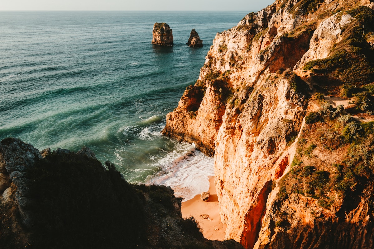
- Adrasan to Gelidonia lighthouse: 10km ridge trail to a lighthouse on a rocky cape — one of the most dramatic single-day sections of the entire Lycian Way (access: Finike dolmuş, 1.5hr from Antalya)
For multi-day Lycian Way hiking based in Antalya, the standard approach is to bus to Kaş or Fethiye and walk back eastward over 5–14 days. Luggage transfer services operate along the route (₺100–200/transfer).
Beydağları Coastal National Park
Distance: Various, 3–20km depending on trail Access: Bus toward Kemer, then trail access points Best season: October–May
The Beydağları Olimpos Coastal National Park encompasses the mountain and coastal zone between Kemer and Finike — including the Chimera fire site, Olympos, Çıralı, and the mountain ridge above. Day walks from the coastal access points reach viewpoints over the sea within 2–3 hours.
The Chimera (Yanartaş): Natural methane flames burning from rock fissures in the mountain above Çıralı — accessible by a 45-minute uphill walk (₺50 site entry). Best visited at dusk when the flames are most visible. Combined with a Çıralı beach day, this makes one of the best full days accessible from Antalya.
Day hike logistics from Antalya
| Destination | Transport | Journey time | Cost (transport) | Best season |
|---|---|---|---|---|
| Termessos | Bus + taxi | 1 hour | ₺150–200 return | Oct–May |
| Köprülü Canyon | Bus + taxi | 2 hours | ₺120–200 return | Mar–Nov |
| Kemer (Lycian Way) | Dolmuş | 40 min | ₺30 each way | Oct–May |
| Olympos/Çıralı | Dolmuş | 1.5 hours | ₺40–50 each way | Mar–Nov |
| Chimera | Dolmuş + walk | 2 hours | ₺40–50 one way | Year round |
Essential kit for Antalya hiking
The Taurus terrain is rocky limestone — ankle-support hiking shoes or boots are worth using over trainers. Sun protection is essential from April–October. Water: carry 2–3 litres minimum; sources are sparse on most Taurus trails. Navigation: the Lycian Way is well-marked but Termessos and the mountain trails require either a guide or the wikiloc/maps.me GPX track (both freely available).
Guided hiking: Several Antalya-based operators offer guided half-day and full-day hiking trips to Termessos, the Beydağları, and Köprülü Canyon. Prices: ₺400–800/person including transport. Worth considering for Termessos if unfamiliar with unmarked trail navigation.
For the coastal towns accessible as part of multi-day hiking routes, see Antalya coastal towns. For the full Lycian Way context, see Kaş hiking and Fethiye hiking.
Ready to explore?
Browse hundreds of tours and activities. Book securely with free cancellation on most options.
Browse on GetYourGuide →We may earn a small commission — at no extra cost to you.